

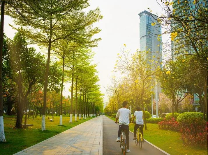
This summer, the cycling community in Guangzhou has become a vibrant sight to behold. Whether riding at dawn or under the night sky, exploring ancient streets and alleys steeped in history, or cruising along the green paths in the outskirts to feel the refreshing breeze, cycling has evolved into a new way to embrace outdoor activities and explore urban spaces. Behind the "cycling fever" lies a prevailing green and eco-friendly mindset, diverse social interactions, and a collective pursuit of health, reflecting Guangzhou's evolving transportation trends.
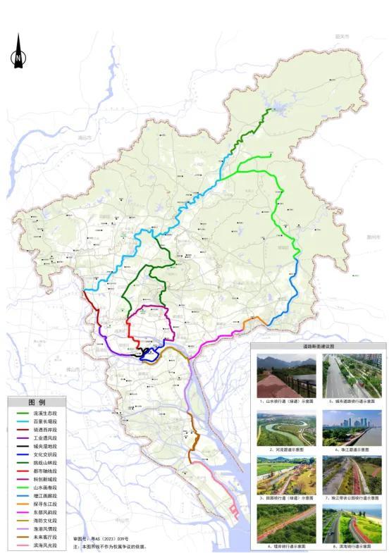
Recently, the Guangzhou Municipal Planning and Natural Resources Bureau, in collaboration with Amap and Baidu Maps, launched eight cycling routes totaling 240 kilometers. Citizens can search for "Guangzhou 520 Cycling Route" on Amap or explore it on Baidu Maps to discover recommended routes such as the scenic spots of mountain and sea, Zengjiang Gallery, and Cultural Interweaving.
Guangzhou, known for its blend of mountains and rivers, rich historical and cultural heritage, millennium-old commercial status, and as a core engine within the Guangdong-Hong Kong-Macao Greater Bay Area, boasts a landscape of interconnected hills and waterways. Covering approximately two-thirds of Guangzhou's urban area, this green infrastructure provides a solid foundation for developing integrated cycling routes.
Upon this foundation, Guangzhou leverages its natural urban assets to establish an integrated network of mountain and sea cycling routes throughout the city. This initiative aims to connect various cycling spaces into a cohesive network, featuring a main route stretching from the north at Conghua Liuxihe Forest Park, passing through the Pearl River Belt, to the southern coast at Nansha Beach. Spanning approximately 520 kilometers, these routes will link traditional villages, industrial heritage sites, and industrial towns, as well as ecological, agricultural, historical, urban, and marine resources.
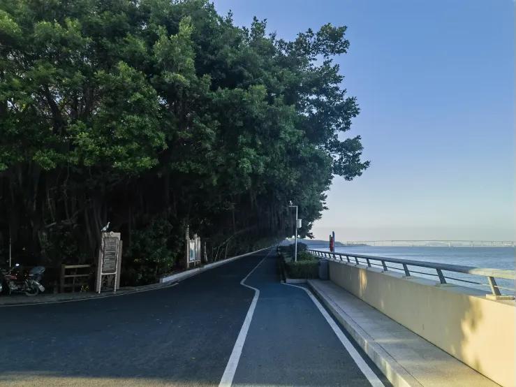
In the future, cycling along the interconnected 520-kilometer cycling routes will offer you a panoramic view of Guangzhou's stunning landscapes, including its mountains, waters, cityscapes, fields, and sea. This initiative aims to allow more and more citizens to experience the distinctive Lingnan scenery firsthand through cycling across Guangzhou's diverse dimensions.

Source :Yangcheng Evening News
解锁广州520公里山海骑行路线图
入夏以来,广州的骑行大军成了一道亮丽风景线。晨骑夜骑,或是探访古老街巷,品味历史的厚重;或是城郊碧道骑行,享受清风拂面的惬意……骑行已成为解锁户外运动、探索城市空间的新方式。“骑行热”背后,是绿色环保理念的盛行、社交方式的多元化和人们对健康追求的体现,也反映了广州交通出行的新时尚。
日前,广州市规划和自然资源局已联合高德地图、百度地图,率先上线已建成的8条共240公里的山海骑行道线路。市民可在高德地图中搜索关键词“广州520山海骑行道”,也可在百度地图骑行板块下查询“山海骑行”,获得山水画卷段、增江画廊段、文化交织段等不同骑行游玩线路推荐。
广州作为山水城市、历史文化名城、千年商都以及粤港澳大湾区核心引擎之一,云山连珠水的山水格局和占据约三分之二广州市域面积的绿色基础设施空间为骑行道贯通奠定了良好的发展基础。
在此基础上,广州立足于城市自然禀赋,着力构建贯通全域山水城田海骑行道,将全市骑行空间贯通成网,形成北至从化流溪河国家森林公园,途经珠江带,南抵南沙海滨的骑行主线,串联传统村落、工业遗产、产业小镇以及生态、农业、历史、都市、海洋等风貌资源点,长约520公里。
未来,沿着贯通的520骑行道骑行,广州“山、水、城、田、海”的秀美风貌将完整地呈现在眼前,让越来越多的市民“骑”在广州,多维立体感受岭南风貌。
文、图|记者 董鹏程 通讯员 穗规资宣
译|林佳岱


-
Navigating the challenges and opportunities of unmanned driving
2024-07-13 22:23:33 -
Twelve international transit passengers embark on a free one-day tour in Guangzhou
2024-07-12 22:15:00 -
"Apollo Go" Robortaxi opens passenger tests in 11 cities: are driver jobs at risk?
2024-07-12 22:15:04 -
Photos | Tapo Temple Fair in Foshan opens
2024-07-12 22:15:09